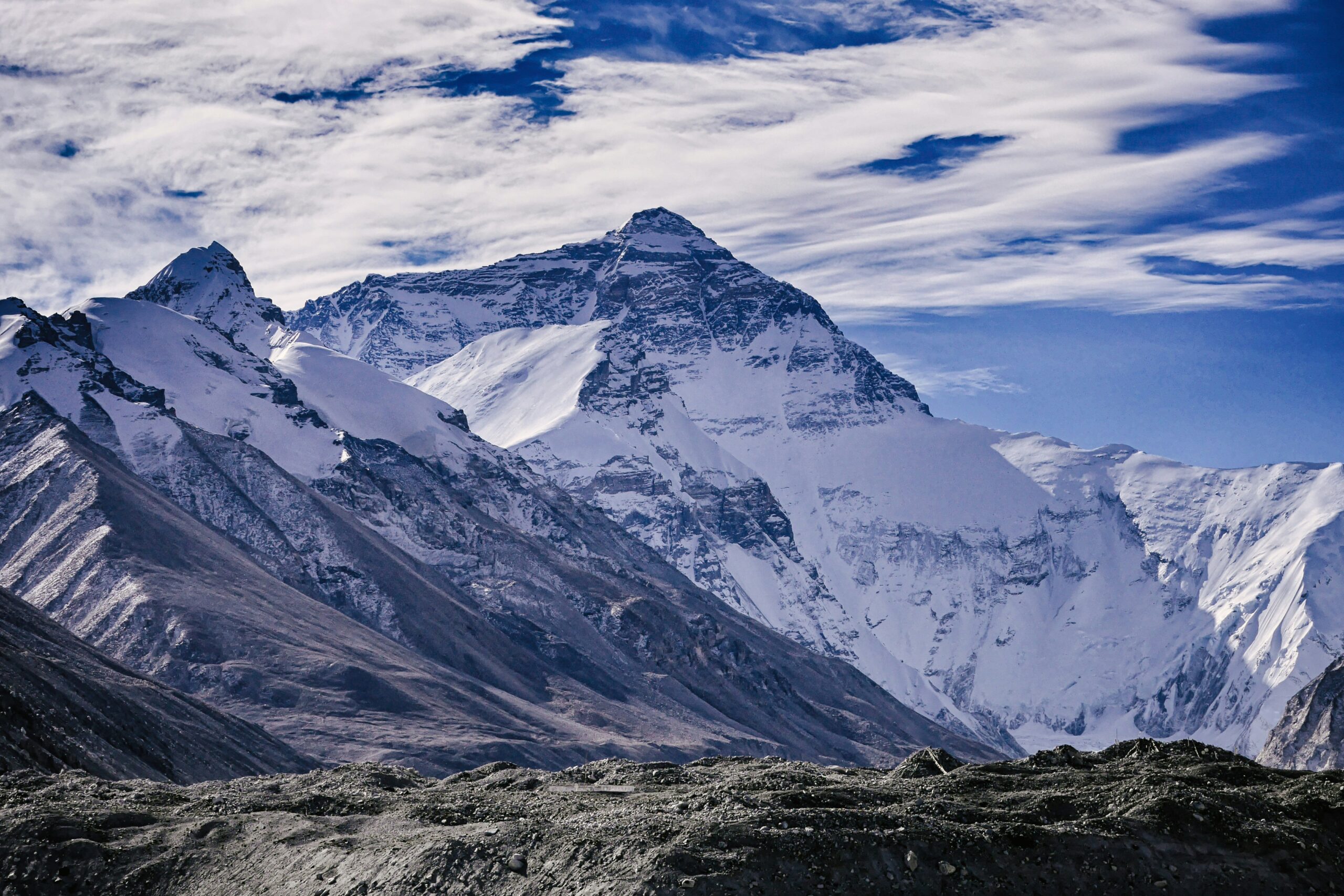
The great rivers and craters around Everest
Mount Everest, the world’s highest mountain, lies in the Himalayas on the border between Nepal and the Tibet Autonomous Region of China. The geography surrounding Everest is dramatic, shaped by tectonic forces, glacial activity, and erosion. Here’s a breakdown of the great rivers and notable geological features (including craters) around Everest:
🌊 Great Rivers Around Everest
Several major Himalayan rivers originate near Mount Everest or are influenced by its glacial systems:
- Dudh Kosi River (Nepal)
- Name means “Milk River,” due to its milky-white appearance from glacial silt.
- Originates from the Ngozumpa Glacier near the Everest region.
- A tributary of the Koshi River, it flows through the Everest (Khumbu) region.
- Important to trekkers on the route to Everest Base Camp.

- Bhote Koshi River (Nepal)
- Flows south from Tibet into Nepal.
- Joins the Sun Koshi and eventually the Koshi River system.
- Famous for white-water rafting and canyoning.
- Arun River
- Originates in Tibet (as Phung Chu) and enters Nepal, becoming the Arun.
- Another major tributary of the Koshi River system.
- Flows near the eastern flanks of the Everest region.

- Koshi River (Sapt Koshi)
- Formed by the confluence of seven Himalayan rivers, including the Dudh Kosi and Arun.
- One of the largest rivers in Nepal, flows south into India.
- Known as the “Sorrow of Bihar” due to devastating floods.
🌋 Craters and Geological Features Around Everest
There are no volcanic craters near Everest — the Himalayas are formed by continental collision, not volcanic activity. However, the region is rich in glacial and erosional features:
- Glacial Cirques and Basins
- Circular or amphitheater-like depressions carved by glaciers.
- Examples: The Western Cwm (pronounced “coom”), a broad glacial valley on the route to Everest’s summit from the south.
- Moraine-Dammed Lakes
- Formed by glacial retreat leaving behind moraines (debris).
- Notable example: Imja Tsho – a glacial lake east of Everest prone to glacial lake outburst floods (GLOFs).
- Glaciers
- Khumbu Glacier – flows below the Western Cwm and is the highest glacier in the world.
- Ngozumpa Glacier – the longest glacier in the Himalayas, near Cho Oyu (close to Everest).
- These glaciers carve out valleys and basins resembling crater-like depressions but are not volcanic.
Summary
- Rivers: Dudh Kosi, Bhote Koshi, Arun, and Koshi are the major rivers shaped by Everest’s glaciers.
- Crater-like features: Not volcanic, but glacial — including cirques, basins, and moraine-dammed lakes.
- Everest’s landscape is defined by glaciation, tectonics, and erosion, not volcanism.

Add a review
Your email address will not be published. Required fields are marked *